Culoul Range Trail to Colo Gorge


I've wanted to do a bushwalk along the Putty Road for a while and I found a trail that looked good. The trail I wanted to do was Coloul Range to Crawford's lookout. If you've read the title to this post, you've probably figured out that this didnt go as planned. The walk out to Crawford's lookout starts at the end of the Culoul Range fire trail. The 4WD trail can be described as boggy clay in sections and a few steep bits. Quite manageable in a 4WD. The road takes about 30 minutes to get to the trailhead. You will find an open area. This is the car park.
From the car park, you will find a small, burnt, blank sign. Behind this is the trail to Hollow rock. I followed this very overgrown trail until I figured it was too overgrown for my liking. More on that later.
Backtracking to the car park I followed the fire trail along the ridge. I was following the track notes from "Discovering Yengo and Dharug National Park on Foot: Including Popran National Park, Anthony Dunk, ISBN 0858811839, 9780858811836". I came to the first Y intersection and turned right. It was a little overgrown but there was a distinct two paths for a vehicle. This lasted for about 50 meters before narrowing to a single trail.
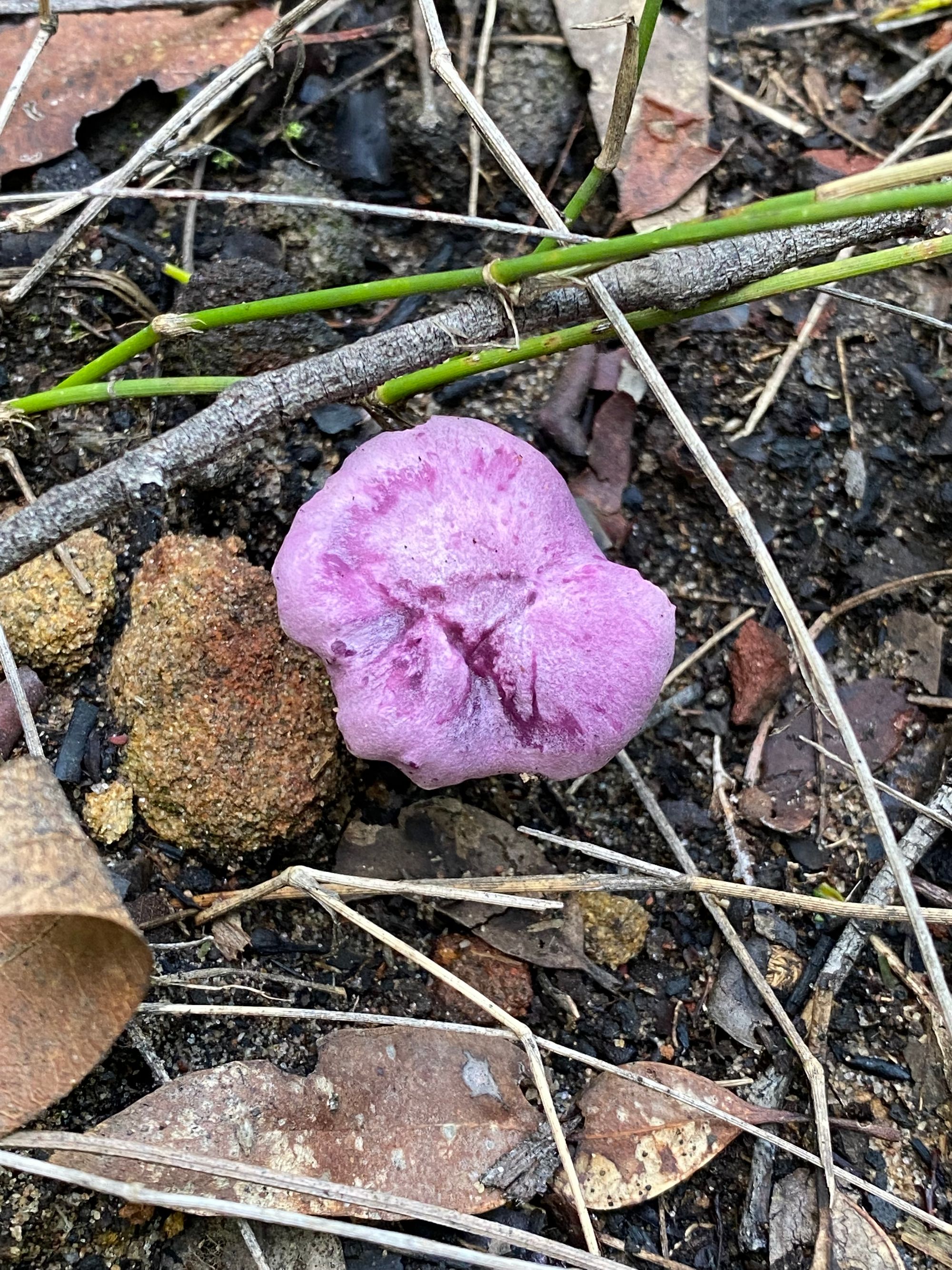
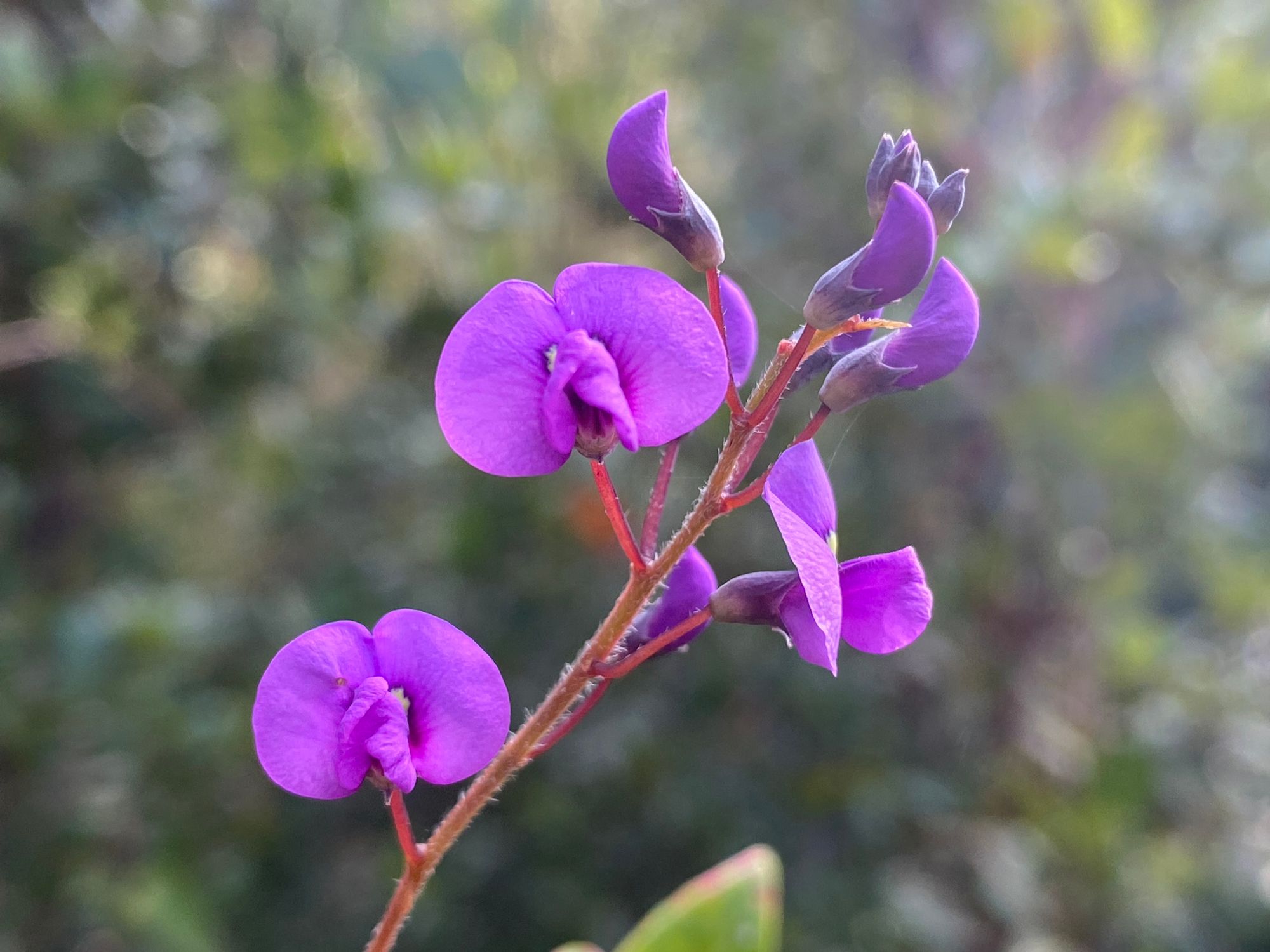
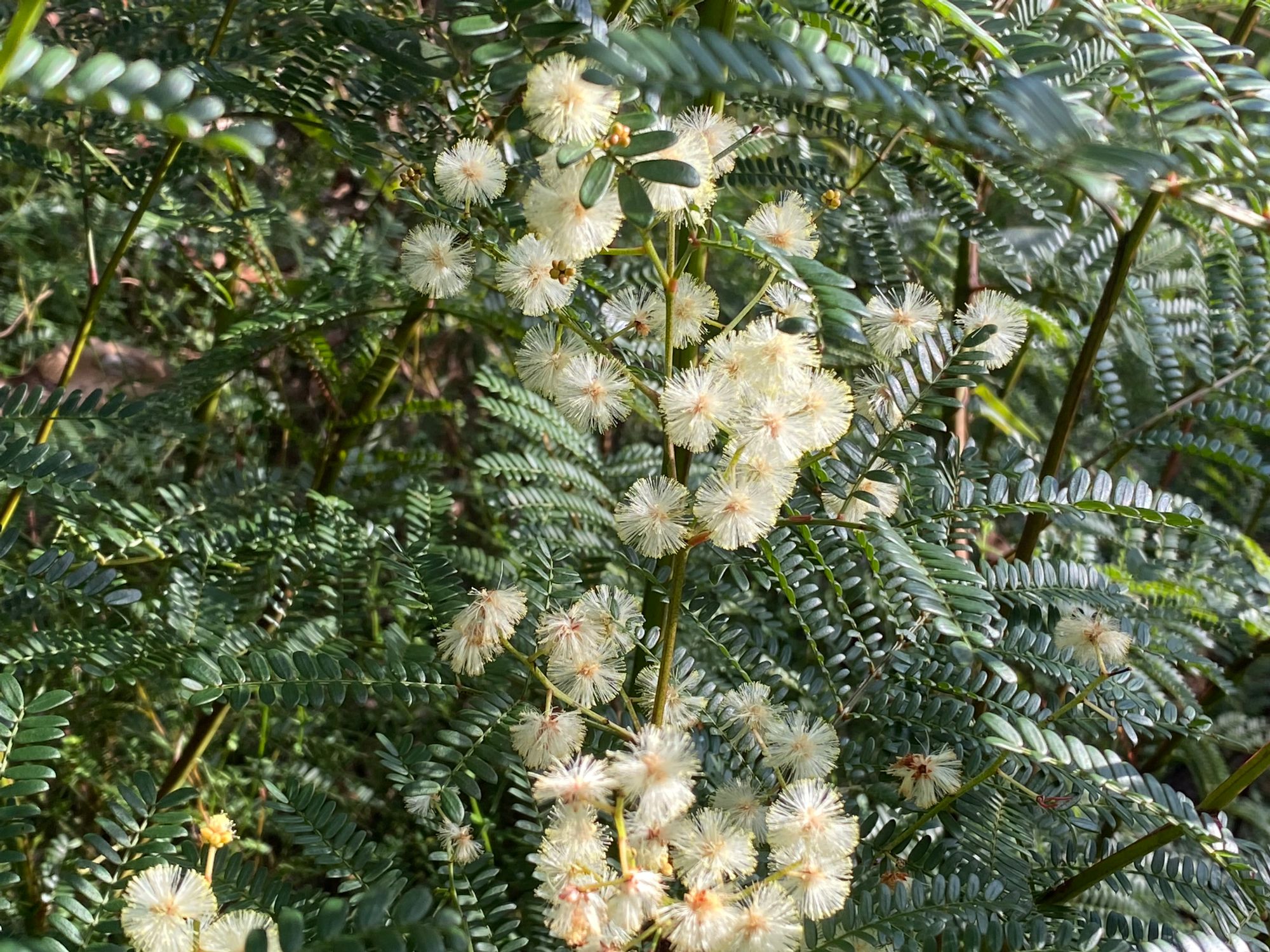
The eastern coast bush is still recovering from the major fires in 2019-20. Right now the undergrowth is thick. We have also had a very wet summer/autumn. Some old walks that were clearly marked are now very overgrown. I was walking one of these overgrown walks.
Walking along the ridge I'm barely making out a trail. Backtracking multiple times to get back to what I thought was a trail. Then after a while, I picked up pink tape markers along the trail. These were very handy just to confirm that you're heading in the right direction. Along the ridge, I'm constantly checking my digital map to see if I'm near the trail that's marked on the map (Gaia Topo). It's a hard slug along the trail, much of it off-trail, heading in the general direction of the lookout.
It opens up a bit and you don't need to fight off the bush. It's a nice reprieve. There's a small view on your right which was a good spot to have a small rest and take in the view. Getting back on the trail, I was hoping that there would be no more thick shrub to contend with. After 50 meters or so it's back again and much thicker.
After a couple of kilometers, the bush thins out a bit. The pink ribbon markers are replaced by cairns. They're pretty easy to follow. I see a few cairns that had tumbled over. I build these back up for the next walker to use.
Finally, I see a decent down to the cliff face. It's quite steep. I take it slow. There are a few big rocks that you need to navigate around.
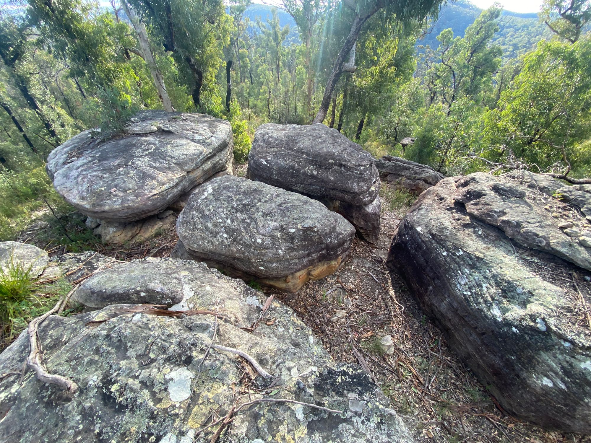
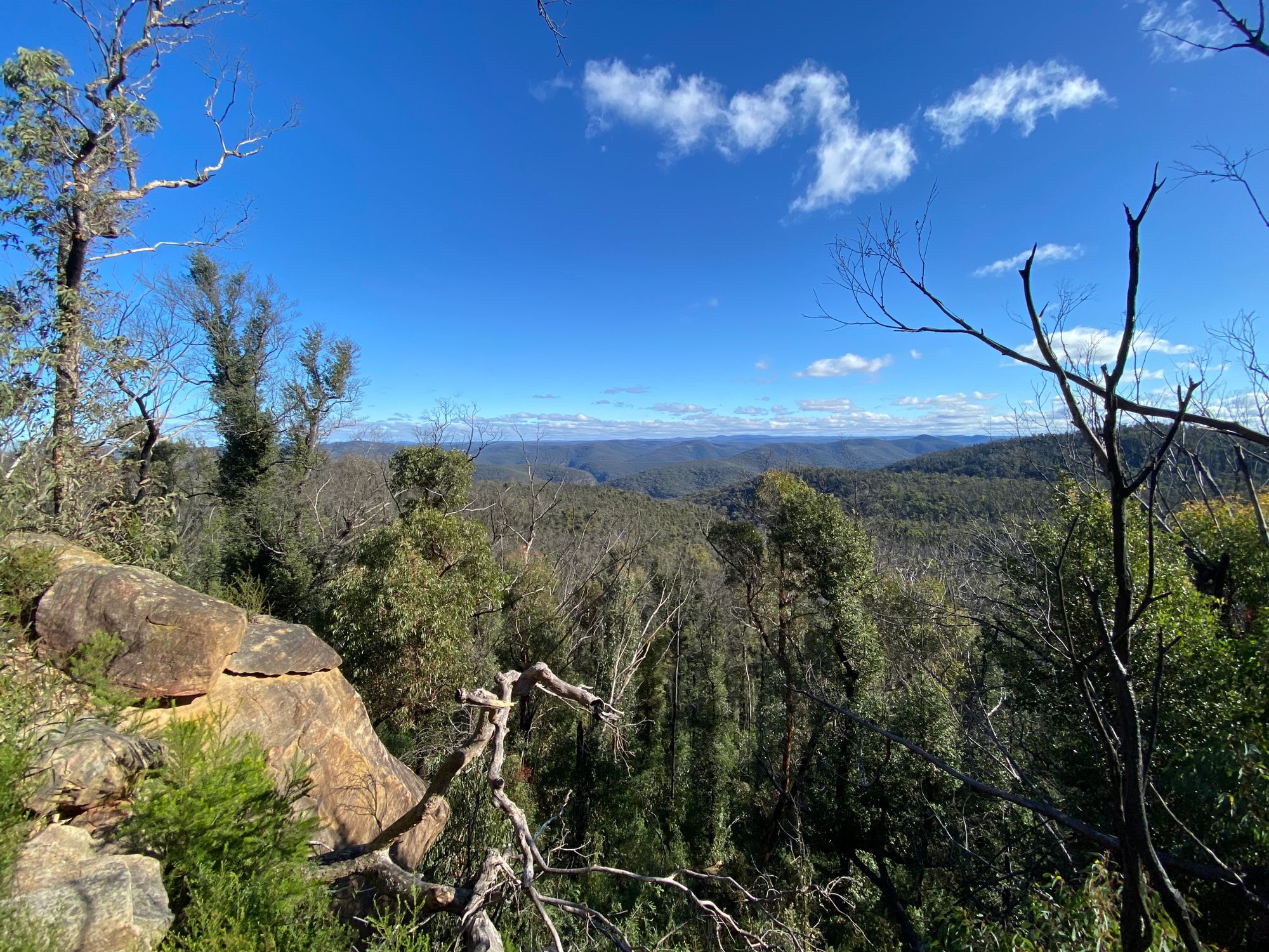
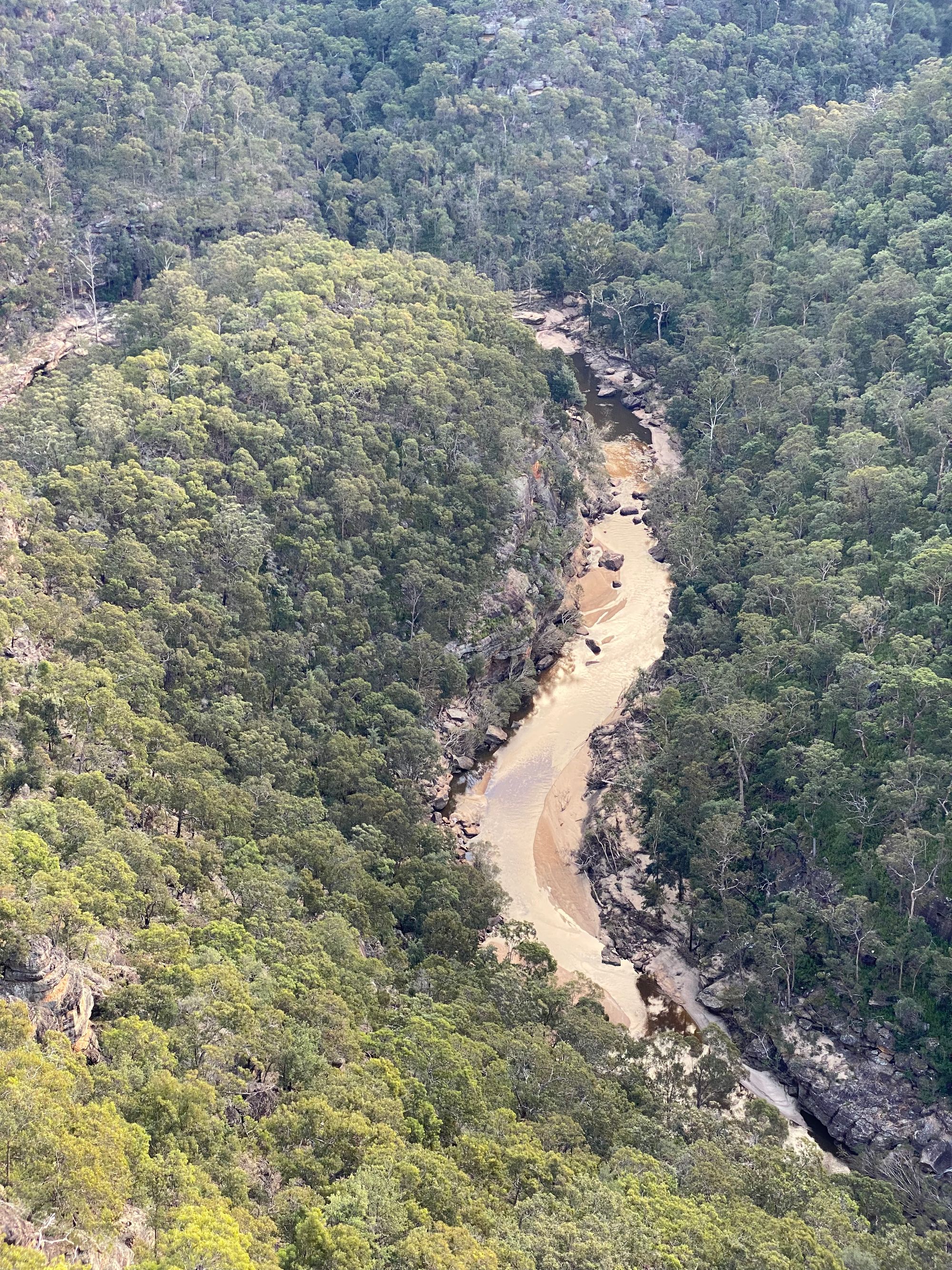
Reaching what appears to be a flat rock platform, you are presented with an amazing view of the Colo Gorge. You can see and hear the Colo River and its sandbanks and rapids.
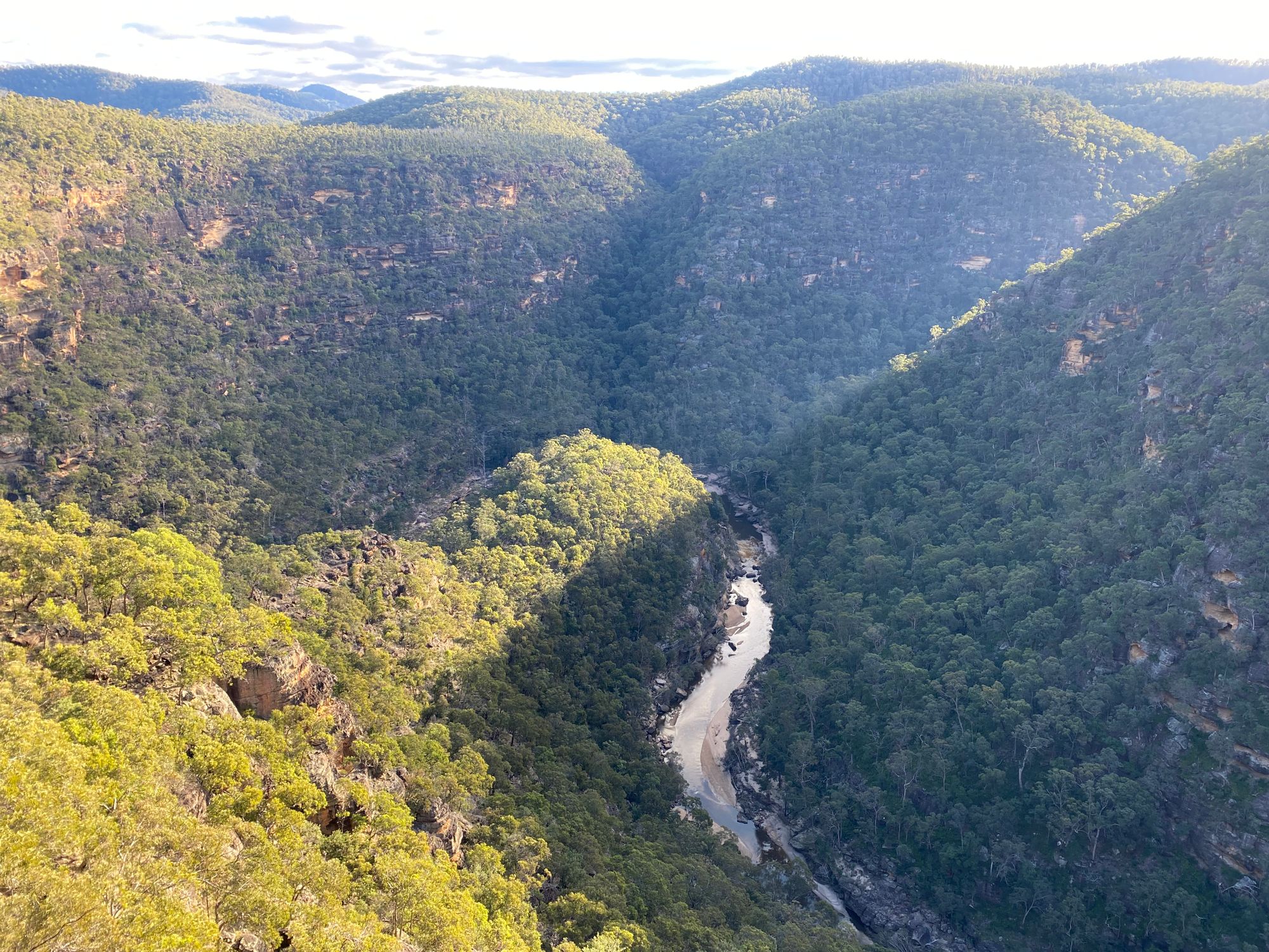
I was not expecting a view this good, to be honest. It made the bush bash in well worth it. After a bite to eat I made an erroneous decision to head back to the car. I had thought I was at Crawford's lookout. It was a stunning view. This must be it. It was not. The lookout is 200m south from the cliff platform I was on. I guess I'll need to come back.
On the way back it was much easier to follow the overgrown trail as I had the route recorded on the GPS. I only went off track once in a section where I never found the actual trail.
I get back to the car just at sunset. I stop for a minute and it's absolutely quiet. No birds, no wind, nothing. Just silence.
With that, I hop in my car and slowly 4WD out to Putty Road under the cold winter darkness.